I got messaged again for a ride on a saturday I couldn't do due to my daughters netball grand finals, and they'd be too busy at the pub on sundays. So I organised my own Adventure ride, with blackjack and hookers. Ah forget the blackjack.
So a little looking at maps on saturday night I headed out early 6:50am on sunday morning to beat the predicted 34°C heat. Heading into the Blue Mountains will also be good as it will be much cooler up there. This is going to be a photo heavy post.
Rolling along the Doom Highway towards Suttons Forest it was pretty cold at 14°C with no liners in my suite. I was ok with it as I knew this afternoon would be stinking hot.
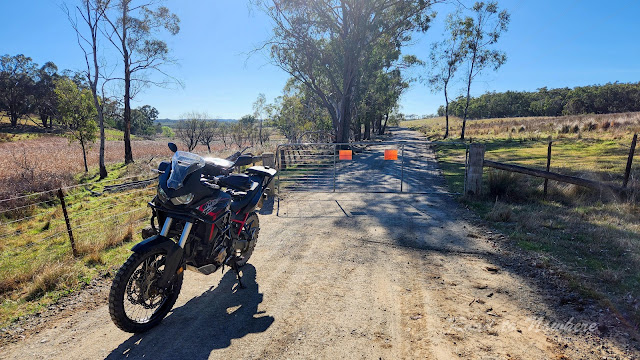
I grab some fuel at Sutton Forest and turn around and head back to Canyonleigh road, which quickly turned to dirt through farming land. I came up to a gate on the road, said private property but then public road underneath, so proceeded only to find another 2 closed gates within the next 2 kms. I just kept opening and going through.
I then turned north onto Brayton road and head towards Swallow Tail Pass. The ride along here was pleasant. I could see the pass coming up as the road suddenly dropped away into the valley.
The sign says below says a lot, sub standard road ahead. Haven't seen that before but it was in better condition than some of our tarred roads. It also says how responsable australian gun owners are.
It was pretty easy riding actually descending down into the pass even though it was slow. I wouldn't like to ride in here in the rain, that could be disaster waiting to happen. At the bottom was a crossing of the Tarlo river. I stopped here for my first break, had a banana and and Iced Coffee whilst taking in the serenity.
I never thought coffee in a can would be any good, but I quite enjoyed this coffee. Small and easy to carry too. Thanks for the tip Warren.
After the climb out of the gorge, I came upon a creek crossing which I initially slowed down for it, before thinking momentum is my friend and gunned it. Water was gushing over my helmet, onto my visor, tank bag and phone. Maybe I sent it a little too hard lol. Well I'm new to this adventure bike thing after all.
From here I followed the road into Taralga. Passing a church here I thought I'd drop in, it was sunday after all.
They were closed, lucky for them or the place might have caved in if I attended. Next up was passing by Taralga wind farm. I've stopped here before on my R1 so thought I'd get a pic with my Black African.
It was quite windy today and these windmills were spinning quite quickly. I could see the flex in the big blades.
Rolling into Taralga I notice this big old church. I thought I'd stop and take a photo for my bro as he has some sort of church fetish. Enjoy bro. I don't go in for those shenanigans.
I rolled straight through Taralga, the pub was closed it was only 10am and the town was pretty deserted. I headed straight out Wombeyan Caves road, then turned up Langs road which linked to Range fire Trail. The track got a lot narrower and rocky with ascents and descents with many blind corners. Plenty of erosion mounds to jump.
I stopped to look at this Limeburners Fire Trail, I'd heard it was a good ride. It was closed and gated. The fines in this country are out of control, check that sign out.
Off I went, the road followed the ridge line along for quite some time. I only saw 2 4wd's along the whole route, and they were on the wrong side of the road as was I when avoiding a piece of trail that was a bit sketchy. Bit of a pucker on a blind corner at speed. Pretty easy riding for most of the way. The temp had risen to about 25°C and was still fairly pleasant even going slow.
I went over one erosion mound going up hill that had a huge hole on the other side with a massive mud filled puddle. The front forks bottomed out, I could hear the loud thud & crack from the front end.
It wasn't too long before I popped out at Mt Werong and I rode around the campground for a look see. Was no one to be seen so I kept riding along towards shooters hill and my lunch stop at Oberon.
I stopped for a quick look at the information bay on the Mt Werong road. 60kms into Yerranderie and it's a dead end and you have to turn around and come back. It's part of the Warragamba Dam catchment and you can't go any further or $44k fines.
The road eventually pops out onto the Shooters Hill road, which I've written about many times on this blog. Beautiful countryside up here around Oberon. Will have to come and explore some of the forest trails.
I had a hunger for a steak sammich, but thought it would take too long waiting at the pub so opted for the bakery in Oberon. These guys are liars. Says Australia's best bakery NSW winner for 2011 on the sign. Reading that I had BIG expectations, sadly they under delivered with a thermonuclear pie and that was after waiting 10 minutes for it to cool down, then it fell apart trying to eat it top falling off and contents falling out everywhere. Pie rating - 2.5/10. I should have stayed with the steak sammich option. This is possibly the worst pie I've had in many years to be honest. 😞
After lunch I got underway quickly as there was plenty of smoke in the air from some nearby back burning. I didn't want to stand around breathing that crap so headed out for Jenolan State Forest.
This was a nice ride through the forest. There were two main route through here, I followed Ridge Road and it was a cracker, followed the ridge line through the forest. Some pretty extensive logging has been happening. That made way for views of stunning vistas.
I pressed on and got over the next hill before stopping for another photo. Up the hill the road re-entered the forest again and got very narrow and dark but nice and cool. I love these pine forests.
The road put me back onto Jenolan Caves road, which I turned north but quickly turned off again on Boggy Creek road and made my way to the Six Foot Track. I stopped at the sign. It said the creek 20km ahead is unpassable if 0.9m high and will have to turn around and come back. Check the floods near me app.
No phone reception here. Yeah great government departments at their best. There are also 2 signs pointing in 2 different directions for the six foot track. I can't remember which way and google maps not working. I check Gaia maps and it was working and showed my location and the track, beauty I left that on and kept going forward. I think I'll have to invest in a proper GPS, phone is useless out here.
There were a few sandy patches along the track caused a few wobbles. I got to this little intersection and stopped at first confused were the road went, it said walking only then I noticed the road went left over and down the hill. It looked very steep too. I took a long drink from my camelback. Then 2 guys came up the hill on the KTM & Husky dirt bikes. Both stopped to see I was ok, gave them the thumbs up.
The road dropped down the hill steeply over the next couple of kilometres it dropped 600m, steep slippery gravel, rock patches, big ruts. The rear tried to overtake the front wheel a couple of times down here. It was at this moment I realised I'd done the exact same thing my brother did a couple of weeks ago. Went riding in remote location and didn't tell anyone where I was going. I think i'll need to get a Garmin inreach now just in case. I'd only seen 2 guys for the last 2 hours.
As I got to the bottom of the hill there was a creek crossing. I stopped for a drink and a photo. After I got going again there were 3 more creek crossings. I hit a rock in the last one nearly put my feet in the water but gassed it at last moment and shot out without getting wet.
I finally got to the bottom of the hill and the end of the rideable part of the Six Foot Track. You can walk the rest of the way to Katoomba from here, but didn't have a mental disorder so keep riding along Glen Chee Road which takes you to the Great Western Hwy via Cox River Road.
The road was that small pea gravel surface and was actually quite slippery, so had to be careful. There was still stunning views all along the valley here and the riding was good.
I stopped at the little bridge above for my last couple of photos and thought I'd better get in at least one shot. On the way back up the range to the main road I took one last photo of the views over the valley. Some beautiful country in here.
As I dropped out of the Blue Mountains back onto the western plains the temperature soared to 34°C, tiring after that ride. Finally got home around 4:30pm pretty knackered after 9.5hrs out on mostly dirt roads.
Time to unleash the Kraken....
Cheers & thanks for reading.


