Friday, March 30, 2018

Tasmania 2018 - Day 11

Day 11


Tasmania Day 6

Today was to be our last day in Tassie which I could sense that everyone was a little bummed out about. Another couple of days here would have been fantastic. But all good things must come to an end.We had some breakfast then checked out of the hotel. I was surprised we were up so early after such a big night out.
From my window at about 7:30am
Our tour captain didn't have a plan for today's ride so we had to quickly devise something. I think he was a little ride fatigued. So my plan was the road back out towards Zeehan but before that there is a turn off up Anthony Road towards Lake Plimsoll. The first few kilometres of twistes then opened out quite a bit into a high speed sweeping road with views of large vistas and along the side of the lake.


We stopped just past the Lake but I think everyone had photo fatigue as well and no one really wanted to stop and take any snaps. The scenery here was actually quite amazing and I took very little photo's. Time to plan another trip I think, lol. It would have been nice to be able to spend some more time exploring the west coast as it is very scenic.


We came back onto the Murchison Highway about 10km east of Rosebery. I needed fuel and remember that the road over to Rosebury was a mountainous selection of twisty delight. The other guys enjoyed this bit of road as well. Pulling into the only service station in town to get fuel I noticed it was closed. They had prepaid via credit card though. For some reason my card wouldn't work so Dave paid for both of our fuel on the card whilst I gave him the cash. That could have ended my day pretty early on stuck here with no fuel on a Sunday morning.

We stopped at Rosebery bakery(yes I know yet another bakery) for some morning tea whilst we tried to find out whether the road up the coast to Authur River was sealed as everything I'd seen so far says it was dirt.

Every single person we asked was either not from Tassie or not a local so we decided to continue back up to Hellyer Gorge again as we didn't want to get caught stuck going slow on a dirt track a long way from the boat. Doug wanted to visit Stanley as something touristy to do. I hadn't been to Stanley since I was a teenager so it I was interested to see it again. The ride along the coast has some great ocean views but as far as riding goes it was pretty uninteresting.


We hit some more wet slippery road works on the way up to Hellyer Gorge which caked the bikes in mud/clad/lime. Again I couldn't see my number plate or brake light.


It was another fantastic ride back up through Hellyer Gorge and then we headed on up to Wyndham. The ride down to the coast was a great little run where you could see the ocean in the distance but twisty hilly road winding down towards it. Great stuff.

We stopped in Wyndham and got some more fuel before we headed out towards Stanley. Stanley is famous for what is called "The Nut". It's actually an ancient volcanic plug. It has step sides and a flat top. There is even a chair lift that can take you to the top. We stopped off at the lookout on the way in and took a few photo's.

The Nut

The other Nut

We arrived in Stanley and yes it is a very small place. But that's not to say it's not a beautiful place. We all wanted to grab some seafood lunch. I really didn't want to sit down at the restaurant but more or less just have fish and chips by the beach or marina. Finding nowhere good to sit around the water front we eventually had our fish and chip lunch in the park.


The houses at the bottom of the nut are very old school architecture and very pretty. Looks like a nice place to live. Walking down to the marina the colour of the water was beautiful aqua blue and emerald colour. 


Stanley Harbour


Stanley Boat Ramp
It was about 3pm by the time we had left Stanley and headed towards Bernie and Devonport where we had to be back to the boat. The boat wasn't due to leave until about 9:30pm so we still had plenty of time so once we got to Burnie we decided to head down around a few of the other little back roads on the northern part of the Island.

We stopped in at Woodhouse lookout, a fantastic little road out in the middle of nowhere with no one on it. This road is a 'B' road out through the little farming communities. There are lots of elevation changes on this road with forested mountains to hilly farm lands and little river gorges. Fantastic views from the lookout.


Woodhouse Lookout


We arrived in Devonport just before 6pm and filled up the bikes. Whilst at the petrol station a couple of guys pulled up in a 1938 Alfa Romeo open wheeler. The owner was one year younger than the car. He was pretty enthused to show of the car opening the engine bay to show us. He was wiping oil off of the engine bay door after opening it.


Looking over the car Stu says to the gentleman owner of this beautiful Alfa. 'The boot's not very big'. His reply was 'your prick's not very big either'. There was laughter all around. BAM wasn't expecting that.


We had to wait for the boarding time on the ship so we went to a local club and had some food and drinks and waited. About an hour from departure we rode down to wait in line. It seemed like we had to wait about an hour till be could board the ship again, by the time we got on and dumped our gear in the room it was about 10pm. A few wind down beers before we hit that little tiny cabin. This time I put ear plugs in and actually got some sleep.


Tassie is such a beautiful place to ride that 6 days was just over with far too soon. Two weeks would have been a much better trip as you could do some touristy type things as well but there are so many places we just didn't get to see and fantastic roads that we missed out on riding. Perhaps another time. 


If your thinking of riding Tassie my advice is just do it you won't regret it. We booked our accommodation in advance as there was 6 off us travelling around. If your travelling by yourself you might be able to wing it and get accommodation as you go but if your in a large group I'd recommend you book in advance.

You might want to check the road conditions before you come as well as a lot of roads look like sealed roads on google map but in reality are small one lane dirt tracks. Fine for Teneree riders not so much for sportsbikes.

One of my biggest tips for riding tassie would be to not ride around near dawn or dusk and definitely never after dark, there is so much wildlife in this place you can spot road kill on the side of the road every couple of hundred metres. That means no 1600km rides in 24 Hrs Andrew. Another good one is to be careful with fuel stops. If you have a small tank make sure you fill up early as some places just don't have any fuel available or are not open after lunchtime on Saturday. Gordon River road has 1 fuel stop along in 105kms and its a one way road.


Todays Map Reference

Thursday, March 29, 2018

Tasmania 2018 - Day 10

DAY 10


Tasmania Day 5


I was up fairly early this morning around 6ish and was hungry so I made my way to breakfast. The other guys slowly arrived. We packed the bikes and headed back to Westerway for fuel. We were going to do some riding around the bottom of the great lakes but looking at the forecast they were predicting rain in Queenstown from 2pm-5pm so we changed the plans and headed straight for Queenstown so that once there we could decide on riding options with whatever the weather was doing at the time.

We headed back up the way we came the yesterday and crossed the Derwent River again and got back onto the Lyell Highway heading toward Derwent Bridge. The Derwent River was so still this morning it was a mirror lake, stunningly beautiful and I only took 1 photo.


We passed some bicycle riders on the steep winding hill at Tarraleah where the power station is right beside the highway. I thought of my brother struggling up those steep hills, whilst I gently rolled on the gas and shot up the hill like a rat up a drain pipe. Man invented engines for a reason, thank you Yamaha for that sweet sounding crossplane engine.

We stopped in Derwent Bridge at the Hungry Wombat cafe for coffees. The two young girls serving us were both backpackers, one from France and the other from Nepal. I wonder how they met up and how they ended up here in the middle of nowhere?

The Lyell highway from Derwent Bridge onwards to Queenstown is fantastic for the whole way. Its 86 kms of twisty tarmac and when its not twisty there are sweeping bends galore, with so many elevation changes and beautiful scenery. I really was enjoying this part of the ride so a good flowing road with lots of twisty bits and the scenery is magic, thick forests, big lakes and large mountains. What's not to like really.


R1 on the Lyell Highway

Along this section of road we saw a lot of bikes heading in the opposite direction, sportsbikes, touring bikes and a few harleys at the back. All the local riders must be out for a saturday ride. There must have been about 30 bikes in all. It's easy to see why this section of the Lyell highway is fantastic, the surface is mostly good with the occasional rough patch but on the whole the road is very good.

The road bursts out of thick forest and onto the bridge at Lake Burbury just before Queenstown. The scenery here is beautiful. The view from the bridge over the water towards vistas in the distance is sublime. I noticed that even though it was saturday there wasn't a single boat out on the water. Surely these waters are full of trout, where are all the fisherman and recreational boats?


As I'd stopped a couple of times for photo's the other guys had gotten ahead of me. So I took my time now and cruised along at whatever pace I felt comfortable. Climbing up the hill from the lake I came upon the guys, they were heading up to Iron Blow Lookout.

Iron Blow lookout is a lookout over the surrounding mountains but with a difference. It also looks out over the Iron Blow open cut mine. The whole of the Queenstown area is a large mining area. The slopes of the mountains here are mostly bereft of tree's and vegetation due to acid rain from the smelting and mining dating back to the  late 1800's.

Pulling into the carpark we walked out onto the cantilever bridge and lookout over the surrounding scenery to the east back to Lake Burbury. Beautiful in it's own unique way. Looking down was an amazing view over the old copper mine. The water was an amazing emerald green colour. The water gets it colour due to all the minerals and ore that is in the water.


Iron Blow Carpark


Iron Blow Copper Mine
We stopped in briefly at the look out over Queenstown and took a couple of quick pictures. I also put the gopro on to grab some footage of this magic road. I think it would be much better riding the road up hill rather than down hill the way we went, but still it was good fun. I was in first gear the whole way down the hill it was that tight.

Bushpig riding the Queenstown bends


Welcome to Queenstown


Road down to Queenstwon


Another short video this time of the 99 Bends into Queenstown. Skip if you don't like videos. Thanks Bro it's no spielberg effort.


By the time I got to the bottom of the hill and into town the boys were already at the pub. Our accommodation for the night was the Empire Hotel. Funny enough it's the same place Flyboy and I stayed at 15 years ago, but I couldn't remember much about the place.

Again we unloaded our luggage from the bikes so we could ride them without the extra load but we took our wet weather gear just in case. The clouds were starting to roll overhead now getting darker and the clear blue sky's of this morning were gone. It was quarter to 1 and we decided to head over to Strahan as it was a great ride and we would grab some lunch when we arrive.

Empire Hotel


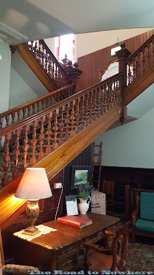
The pub was built back in the 1800's and it had this big majestic staircase that went up the centre of the building and turned around and went up to the next level and to the accommodation.

Awesome stuff that you don't see much these days. I love coming to these little country town pubs, it's amazing sometimes what you see.

It probably stems back to when I used to live in a small country town in central western NSW. Most of them were built in the 1800's and had intricate detailing on the ceilings and the mason work is just not done these days.


Queenstown

Queenstown Train Station

Bikes overshadowed by Mt Lyell
I lead us out the Zeehan Highway to the Strahan turn off and out past Queenstown airport. It looks like a very small airport. Just as I was about to er, ahem start the spirited riding a police car passed us going the other way. That was a bit of a surprise. Then we came into the twisties and I put the hammer down. Yeah I was having fun here. So much fun I didn't take any photo's, but the road into strahan is not a road that you can photograph as you would only see one bend anyway.

We parked out the front of the pub in the main street, prime parking spot. There were not a lot of people about for a saturday afternoon in such a beautiful tourist location, strange really. Oh well better for us then. I really hate busy places. Makes me wonder why I live in Sydney sometimes, it doesn't get much busier than that.

There wasn't much in town to eat at so we found Banjo's bakery and got some lunch there. The great bakery tour continues. Sitting out the front of the bakery watching the world go by, I was enjoying the serenity. It was so peaceful and quiet in Strahan.

Strahan Village

Strahan Harbour

The weather was still ok by the time we finished lunch in Strahan so we made our way towards Zeehan. We could see darker clouds approaching but it was still good riding weather so we pressed on. The road out to Zeehan from Strahan has a lot of big straights on it but also has some twisting hilly terrain with great views to mountains in the distance.

We turned off on the outskirts of Zeehan and headed back towards Queenstown. The road was a little straight for a while but then soon got very hilly and twisty. I loved this section of road it was fantastic fun and we didn't really come across any traffic on it at all. The road surface was great and it was so twisty, up hill down dale sort of stuff. The boys were having a great time.

Zeehan Highway
The closer to Queenstown the road got the windier the road became as it gently descended down into Queenstown. Such a great piece of road with fantastic views in the distance of large mountains. The weather was still closing in and was starting to look like rain but lucky for us we were very close to town now.


Zeehan Highway


Main Street Queenstown

I got back last again due to taking photo's and looked up the main street there was nobody about. You could have fired a shotgun up the main street and not hit anyone. It was eerily empty. The mountain was now covered in cloud, you could smell the rain about now. Looks like we just beat it in and had a fantastic day out riding as well.

We had a couple of quick beers in the Empire then went and tried out the Railway Hotel, we may as well spread the wealth around. Just as we were having a beer in the Railway the heavens opened up, the rain was really heavy so much so you could no longer see the mountain. In fact there was that much rain the roof in the bistro in the Empire collapsed due to a massive water leak.

The rain in the video below was just after it started, we went back inside and it got 3 times as heavy as in the video but I was too lazy to come back out and video it again, haha.


The railway hotel had a rock band that had come out from Hobart so we spent the night drinking  and having a great time. Disco Stu was busting some moves.

Tomorrow was to be our last day in Tassie before we get back on the boat to the mainland.


Today's Map Reference


Tuesday, March 27, 2018

Tasmania 2018 - Day 9

DAY 9


Tasmania Day 4


We were awoken by a knock on the door, it was still dark. I answered and Doug said its time to go. The thick curtains don't let any light into the room and it was almost 9am. Shit we both had a quick shower and got ready to roll out. I was feeling a little seedy this morning and tired, a sign of a good nightout. Bruce had left us early this morning to meet his wife for a few days before meeting us back at the ship in Devonport on Sunday, so that left just five of us now.

Flyboy gave us the pro tip on somewhere nearby to get some breakfast, to which we accidentally stumbled upon whilst we were looking for something else. Thanks bro the Dome in Sandybay had a fantastic breakfast and not too expensive.

After that we topped up the fuel tanks and made our way up to Mt Wellington on the Huon Road. Just before the turn off up the mountain there was a car rolled onto its side blocking our side of the road. I stopped to check if every one was ok. Two young guys probably backpacking, both with sheepish looks on their faces, but both were ok. Looks like it only happen within the last 5 minutes.

The road to the top was a lot rougher than I remember it being and there was quite a bit of traffic on the way up today. It's a very narrow road that winds its way to the top where there is a large car park with views all over Hobart and much of the Island.


R1 above the clouds

It's selfie time

The Pinnacle is only 1270m high but this mountain can quite often be covered in snow, it's even been known to snow up there in summer. Hobart is about the same latitude as Christchurch so it's quite a long way south. We climbed up on to the Peak of the mountain and Doug got this cool shot of us.

Band of Brothers


Hobart


The Pinnacle


On the way back down I wanted to stop and take a picture on the road going down, similar to the picture my brother took some 15 years earlier. They aren't exactly the same but its pretty close with out planning it, even the conditions looked the same with low cloud.

2015 R1 and me overlooking Hobart - 2018
2000 R1 and me overlooking Hobart - 2003

Coming back down the mountain now when we got to the bottom the Police had blocked to road to remove the car that was rolled over. The fire brigade were hosing down the road, we only waited 3-4 minutes before we got through. We headed out through Hobart and out the other side towards New Norfolk. Somehow I was in the lead again as we rode out the Lyell Highway.

I was following the signs to Strahan as there would be a turn off somewhere soon to Strathgordon. We passed a couple of signs saying National Park, I didn't know where or what that was so I continued on and we got to the town of Ouse, Doug said lets get some coffee. There didn't seem to be be much in this town, but I had that funny feeling in the back of my head that something was wrong. My spidey sense was tingling.

Whipping out my phone and checking the map I saw that we had gone past the turn off. 

"How is that possible" I said to Doug, "Did you see any signs saying Strathgordon?" 
"Nope" he offered, he didn't either. I hadn't bothered to check the road number which was the B61. It was the one that was sign posted National Park and we had missed both turn offs to it. Lucky for us Ouse was only 8km past the last turn off so we turned around and headed back. 

This little navigation error reminded me of the problems we had in New Zealand last year, with poor signage. Someone yelled out "Who's navigating here?" To which both me and Doug said "Not me". I may have been riding at the front, but it doesn't mean I was the leader. He was sitting behind me.

As it turned out we came down the Ellendale road which was a fantastic piece of road, with lots of sweeping bends over hills and a smattering of twisties thrown in here and there. We crossed the Derwent River here again, the surface of the water was almost a mirror finish.


We stopped in Westerway for fuel and one of the worst coffee's I had in years. It was just an instant coffee from a packet. Pro tip: Don't buy coffee from Westerway roadhouse it's shit. It's about 105km from here to Gordon dam, so that's a 210km round trip so if your planning on coming this way make sure you fill up and your bike is capable of this distance, VTR rides be warned.

We stopped of at the National Park Hotel which we are staying at tonight. It's really just a little pub in the middle of nowhere. We got our rooms sorted and then took our luggage off the bikes so we would have a better ride. It was about 2:40pm by the time we set of for the Gordon River Dam.

Most of the road along here for the first 60km of this road was sweeping corners with some tighter stuff thrown in through dense forest that came right up to the side of the road. Speeds weren't that fast and there was always the presence of road kill. The first 40km of the road was quite rough as well and could do with some resurfacing, but the cost probably outweighs the amount of people using it. 

It was one of those roads that really put me on edge with most bends not sign posted, not knowing what was going to come up next, and whether or not something may jump out suddenly. 

It took about 45 minutes to travel that 60kms when the road suddenly opened up with huge views of mountains and lakes and rolling plains.We stopped a few times along he to take in the views and some photo's. As the road opened up the speeds increased as well.


Riding along this section I started to enjoy the road a lot more and it was a lot smoother as well. Speeds increased along this section as well. We come alongside a large lake, Lake Pedder. Well what I thought was large. As it turns out is was just a small inlet to the lake that actually sat behind the hill which was 100's times the size of the bit we could see.


Lake Pedder


We continued on into Strathgordon which took about another 20mins so all up about an hour to get the 82kms. There isn't really much there at all, a motel and a couple of houses was about it. There was a little cabana on the side of the road with the remains of a tree trunk underneath. 

It was a Huon Pine that was salvaged in 1975. On the bottom of the trunk was a plaque. The CSIRO had determined that the age of the tree at the time it was cut down it was 2200 years old and was 8 metres at it girth. That is one big tree, I wonder how tall it would have been.


From here it was only a short run up to the dam wall about 12 km's or so. It was a roller coaster ride along between the rugged hills and lakes. The road surface along here deteriorated a bit compared to the last section, I touched the road surface with my hand and the rocks on the road were very sharp, that's why the tyres are wearing fast. The road was also quite bumpy the last 12kms to the dam. 

As you come into the Dam on the right hand side and below the road is the Gordon hydro electric Power Station, a few corners on you come to the end of the road at the Dam itself. 


Book Me


Just as we arrived at the end of the road I saw a helicopter fly over head and land on the top of the mountain just above us, it looked like a rescue helicopter. About 10 minutes later it flew off again to the west. The views over the dam were spectacular to say the least. We didn't walk down over the wall, we could have but didn't really have time for that it was after 4pm already. No one wanted to be riding back on this road through the tree's getting close to dusk.


Gordon River Dam
The Gordon River Dam was built back in 1974 for the purpose of generating hydroelectric power. The dam is a double curvature concrete arch dam 140m tall and is the largest in Tasmania and fifth largest in Australia. Lake Gordon is the largest lake in Australia holding 12 million megalitres. A impressive sight indeed. If you come to Tassie make sure you don't miss this, the place is stunningly beautiful.


Dam Selfie

Here's a video of the road to the Gordon River Dam. Enjoy.


It's a dead end road this one so we turned around and made our way back. On the ride back we didn't stop for photo's and now we had a bit of an idea of the road condition and any surprise decreasing radius corners so we could ride it a little quicker.

The last 40km's of road back out to National Park was pretty rough as I'd mentioned earlier and now I was getting tired and I was getting a pounding. I'd slowed down a little near the end because it was starting to hurt a bit as the others disappeared ahead. We didn't get back to the pub until about 5:30pm, just as I pulled into the car park I saw a cute girl behind a car out of view from the pub but in full view of me. She was standing there in her bra and Thong hurriedly getting dressed. I thought I was going to trowel into the parked cars and bikes as I came into the carpark a little hot and then couldn't comprehend braking whilst checking out the cute girl in her underpants. The things you see when on holidays in the country.

Getting back to my room I was rooted and just lay on the bed for about 15 minutes in my gear before I could get up and get ready to go have a beer. This is the only failing riding a sportsbike, on rough roads they tend to give you a hammering especially when you are 9 days into a ride. My ass was sore but nothing 10 beers couldn't fix.

Beers and Bikes


Surprisingly the pub had quite a few people in for a friday night considering it was in the middle of bum fuck nowhere. There wasn't much around for miles in any direction. Look like a lot of locals had come out as well as a few tourist that are making their way around tassie.

We sat outside near the bikes and had beers whilst talking about the trip it was a great way to unwind after today's ride and spectacular scenery. Someone pointed out my chain was loose, and on inspection it was pretty loose. It wasn't loose when I left home, I checked it. Nothing I can do without any tools, but it wasn't too bad.

On the dinner menu they had a meal called the Meat Mountain. Stu manned up for the big challenge. To eat the Meat Mountain. When it came out  that's all it was, a mountain of meat and chips, no salad in sight. He smile with great delight at finishing off the meat mountain.

It wasn't as late a night as the previous night as most of us were pretty buggered from the night before and the big ride today but we did enjoy a few drinks before retiring for the night..


Today's Map Reference